

2019 CGA Conference: The Geography of Redistricting
Date and Time
Location
American partisan politics have reached a fever pitch, amid renewed and urgent questions on the various threats to democracy. Conversations have intensified on the topic of political redistricting, or the process of mapping electoral district boundaries, and the near actuality that this process will be manipulated to favor a single political party. This manipulation has been referred to as gerrymandering, named for the 1812 efforts of Elbridge Gerry, former vice president of the US and governor of Massachusetts (and Harvard graduate in 1762 and 1765).
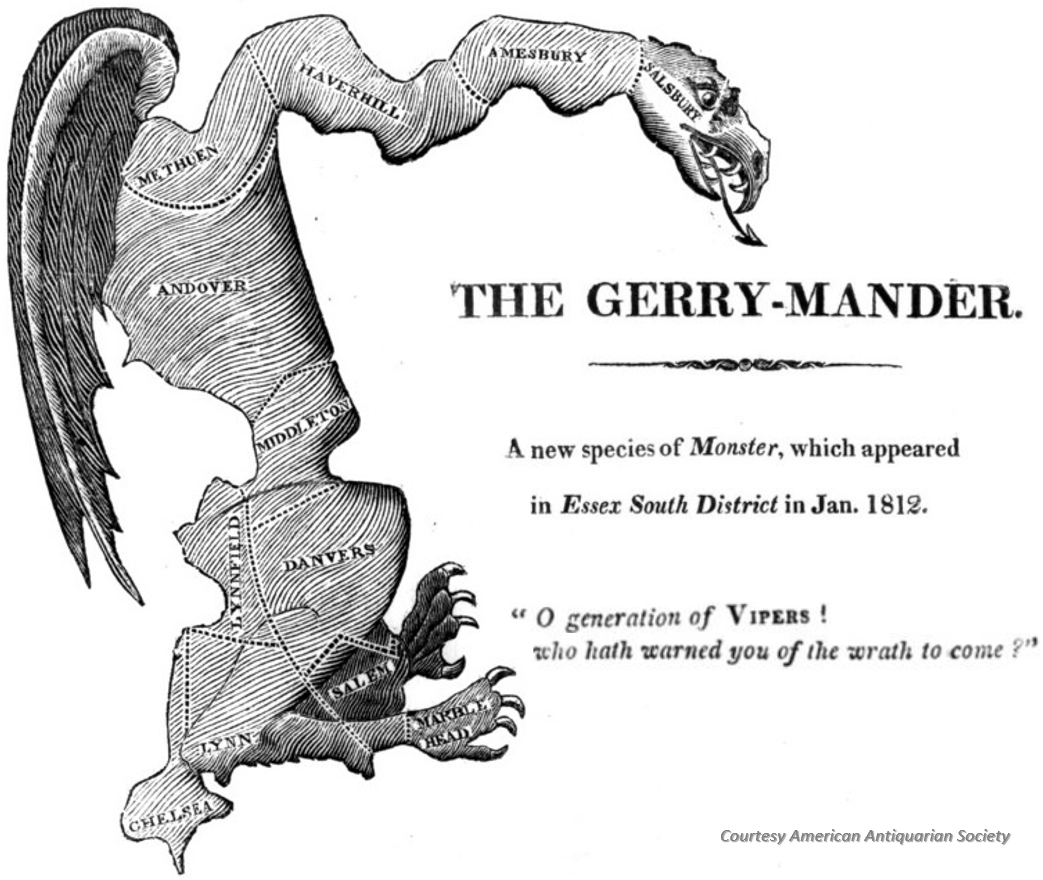
Gerrymandering is a perennial problem of electoral geography. While redistricting is meant to ensure fairness at the heart of our representational democracy, gerrymandering is a divisive tool used by every party in power. How might geographic information systems (GIS) enable a more transparent and analysis-driven process for political redistricting?
This conference aims at bringing together scholars, technologists and activists in geography, GIScience, political science, government, and mathematics, to review the current practice and implications of redistricting, examine how GIS, geospatial analysis, and big data have played a role in redistricting, explore the proper methods and techniques to ensure legitimacy and protect against gerrymandering, and discuss opportunities for improving transparency and fairness.
The event will start with a half-day workshop on Thursday afternoon, with demos of various redistricting tools and platforms, followed by a full day of plenary sessions on Friday, which will include a keynote address, presentation sessions, panel discussions, and closing remarks. Invited speakers will engage with the audience in discussions on the current status of redistricting, its political implications, tools and technologies for redistricting, and perspectives in how geographic insight and geospatial technology may help prevent gerrymandering in redistricting.
Keynotes:
Stephen Ansolabehere: Mapping Politics
Every decade the politics of drawing legislative districts in the United States becomes more intense, and more technical. Technology is often thought to have made gerrymandering easier and more pernicious. My own experience is the opposite. Innovations in GIS software, efforts to make data readily accessible and freely available, and growing analytical expertise have opened and improved the districting process in the United States. The political process of redistricting that followed the 2010 Census saw the introduction of truly independent districting commissions in Arizona and California, the use of public mapping projects in Florida and Virginia, numerous successful cases to improve minority representation, and the first successful federal cases challenging partisan gerrymanders. In all of these instances readily available GIS and data analysis technology was essential. What are the lessons from the 2010 redistricting about the role of technology in the political process, and what can we expect in 2020?

Samuel Wang: Debugging democracy: Using law and data to help bring about fair districting
This decade has seen a record number of partisan gerrymanders in the modern era. Technology helped bring this about - can technology also help solve the problem? Perhaps the most promising approach is state by state reform, through litigation and redistricting commissions. Legal and mathematical theories can be applied in state courts no matter what the Supreme Court does this year. After the Census, redistricting will be improved immensely by public data and open software to give citizens a greater voice when new lines are drawn across the nation. Together, these strategies can help eradicate a gerrymandering, a major bug in American democracy.

Moon Duchin: Geography meets geometry in redistricting
The study of redistricting stands to benefit from stronger interconnections between the domain knowledge in geography and mathematics. I'll focus on the examples of segregation indices and compactness scores to consider successes and failures at the interface across those two disciplines.

This event is free and open to the public.
REGISTRATION
Note: The registration form is Harvard centric, but non-Harvard people are welcome to register and attend this event too. Please select "non-Harvard" in the pick lists, and enter "NA" if you are not working with any Harvard faculty.
Co-Organizers:
Center for Geographic Analysis

Institute for Quantitative Social Science


Co-sponsors:
Ash Center for Democratic Governance and Innovation

Harvard Data Science Initiative


